
Lost Lake
Google map of Lost Lake. ( View Larger Map)
Lost Lake is at the north end of the Mummy Range in the northern region of Rocky Mountain National Park (RMNP) (see google map at right). The trail starts at the Dunraven trailhead (also called North Fork, referring to the fact that it follows the North Fork Big Thompson River). I headed out there for a three-night backpacking trip (for the record, July 15-18th, 2011). This webpage contains some of my favorite pictures from the trip and some comments on the trip and the place. More pictures can be found in this picasa gallery.
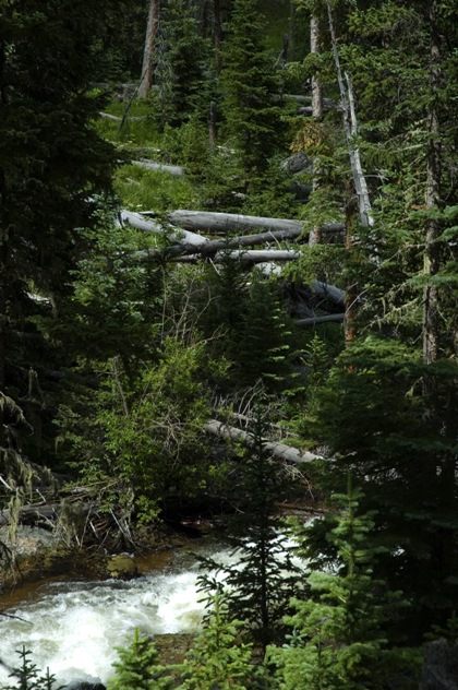
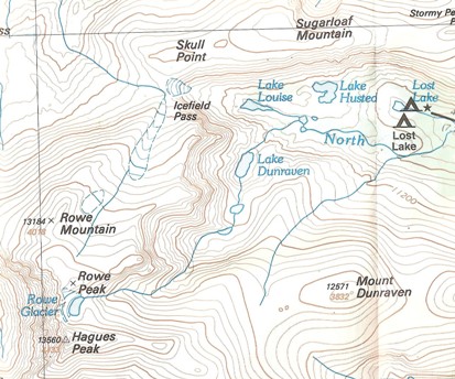
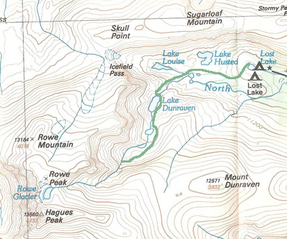
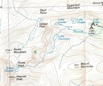
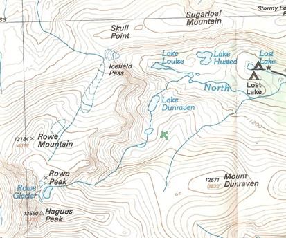
A topo map of the trail is shown below. One can see that the trail passes through the Comanche Peaks Wilderness for four miles before reaching the boundary of RMNP. This section of the Comanche Peaks Wilderness is worth its own trip—ponderosas with spruce, fir and aspen, nice meadows, and the North Fork Big Thompson meandering out of the valley that starts in the basins just west of Lost Lake (where Lake Louise and the drainage that leads to Lake Dunraven are). Several pictures of the area are in the picasa gallery. There are at least nine marked campsites along this stretch of the trail, and they all seemed worth a casual overnighter.
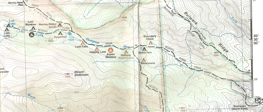
Topo map of the trail into Lost Lake through the Comanche Peaks Wilderness.
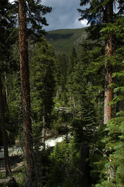
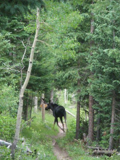
I camped one night at the Boundary Creek campsite. I spent that afternoon by the river checking out the details. I saw a huge, gangly moose, but he bolted. Then, when I was cooking dinner, I thought every rustling leaf was the moose moving through the brush.
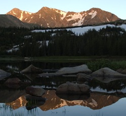
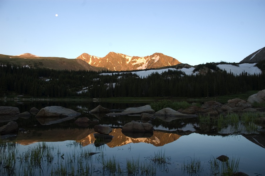
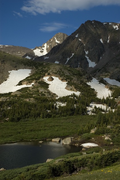
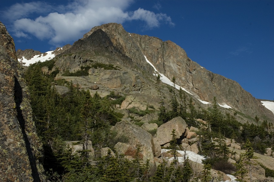
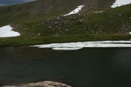
The next day I hiked the remaining distance to Lost Lake. The lake is in a beautiful valley with Sugarloaf Mountain to the north, Mount Dunraven to the south, civilization to the east, and a whole lot of awesome to the west. The most prominent features in the skyline at Lost Lake are the three unnamed peaks can be seen in the picture below. Let's call these Unnamed Peaks One, Two, and Three numbering from right to left.
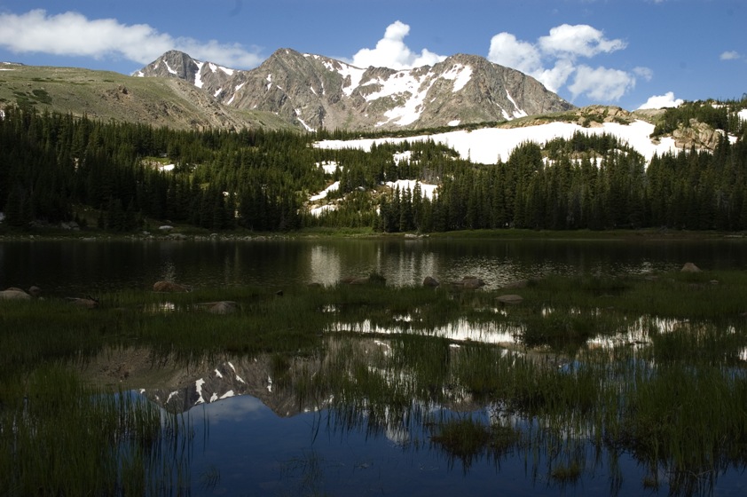
View southwest from Lost Lake. Unnamed Peak One is on the right, Unnamed Peak Three on the left, and Unnamed Peak Two in the middle.
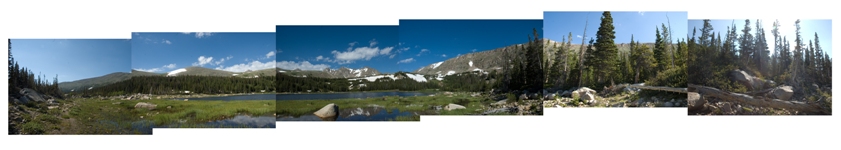
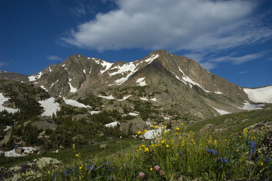
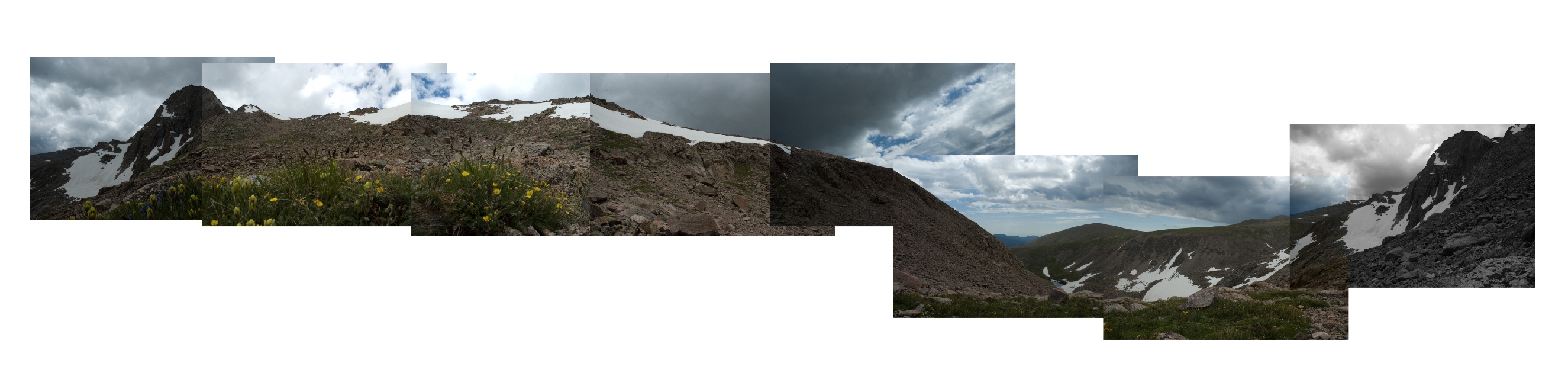
Panorama taken about 30 feet from my campsite. The picture links to a larger version. The three Unnamed Peaks are observable, as is Sugarloaf on the right of the image. Mount Dunraven is behind the first hill left of the three Unnamed Peaks.
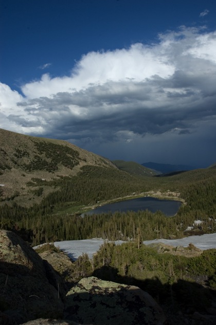
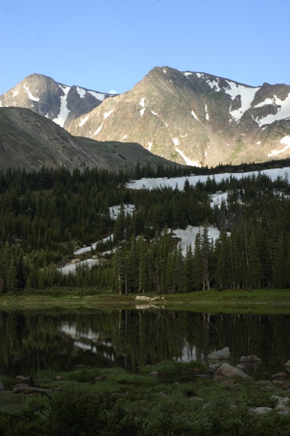
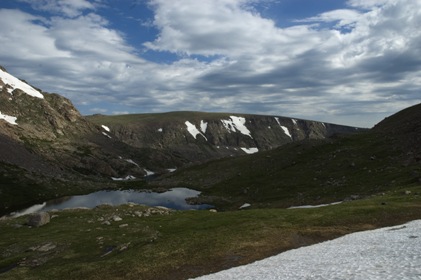
Once camp is set up at Lost Lake there is a ton to check out in the area. The map below shows the region near Lost Lake. On my first day hike I walked along the moraines on the south side of Sugarloaf Mountain. This rock wall is very rugged and textured, and walking along its base is quite scenic. The light wasn't great the afternoon I hiked here, so none of the pics are too spectacular, but you can check them out in the picasa gallery (some of the ones with columbine would have been pretty great with decent light). I followed that wall around to a big meadow with tons of sunflowers and other wildflowers overlooking Lost Lake. These two pictures are from that meadow looking east.
I didn't spend much time checking out Lake Husted or Lake Louise, but there is definitely a lot to explore there. I also saw some people climbing Icefield Pass, and was told it was definitely worth it to get to the top of that. It looks like once you're back there you can summit Rowe Peak from the North, but I'm not sure about this. Something to look into on the next trip.
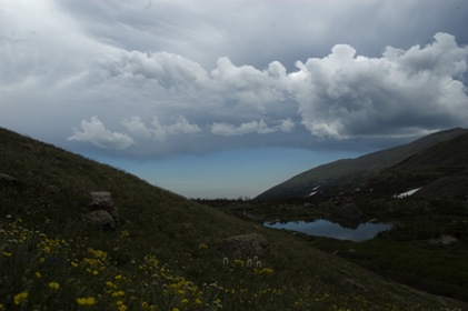
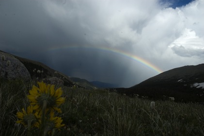
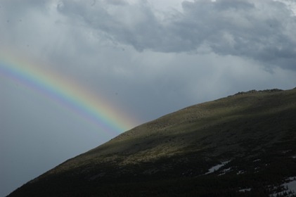
On that day hike along the south wall of Sugarloaf and through the meadow above Lost Lake a nice rainbow popped out in the east. Here are a couple shots of that.
Since the Three Unnamed Peaks all have nice eastward faces, I thought they would photograph well as the sun rose. So I got up early to set up the camera and watch the first red rays light up the peaks. Here are a couple pics. There are a few more in the picasa gallery.
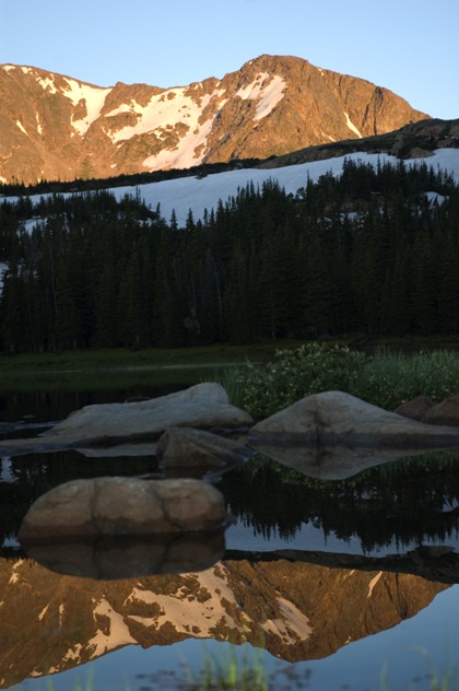
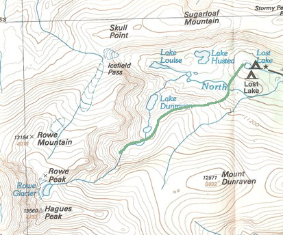
After watching the sunrise I ate breakfast and got moving. The place I was most excited to check out was the drainage below the Three Unnamed Peaks starting with the cluster of three small lakes, going up through Lake Dunraven, and reaching an impasse at Rowe Glacier. Starting out on this hike the light was great, so I took a few more pictures of the three peaks from the meadow above Lost Lake. A few of my favorites are below, and several more are in the picasa gallery.
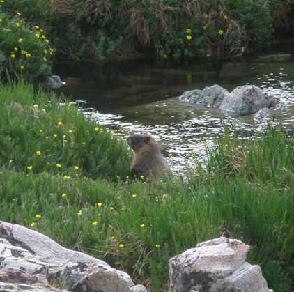
The route I took into the drainage is shown on the map below in green. The section just after the three lakes below Lake Dunraven was a little technical —not at all impassible, but some bushwhacking was required (see image just below marmot and map). Lake Dunraven was awesome, but I didn't stop there for long or take many pictures because I was on the move. There are a few in the picasa gallery.
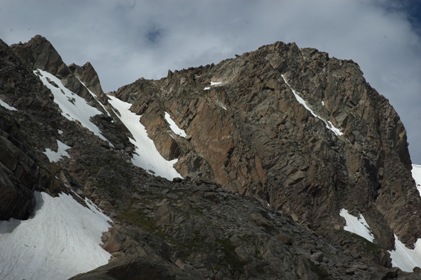
View of Unnamed Peak One on hike into drainage.
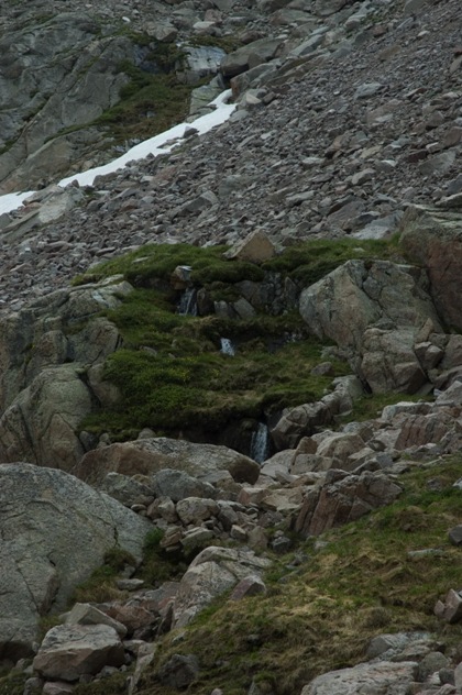
On the way through the drainage there are lots of places for creatures to live. The valley between the Three Unnamed Peaks and Mount Dunraven is lush (in July) and for the most part pretty easy to traverse. Marmots (like the one shown above) seem to have a thriving society there, and many other small mammals and birds called out words of warning as I passed through.
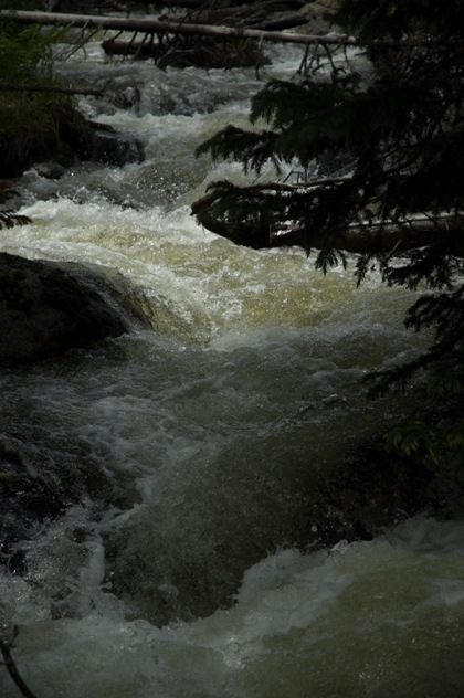
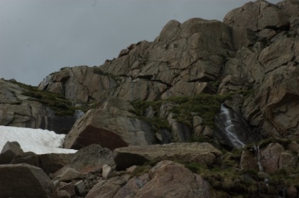
Below are several pictures taken back in the drainage alongside the Three Unnamed Peaks. The melt water from these bowls—the waterfalls and running streams—pass through Lost Lake and contribute to the rushing North Fork.
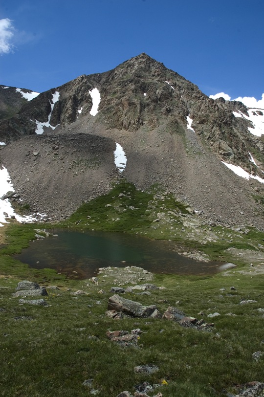
Unnamed Peak Two from the hillside east of the first lake above Lake Dunraven.
 Beyond the third lake (second after Lake Dunraven) I came to the base of Unnamed Peak Three. By now it was around noon, and I had some
lunch. The clouds I could
see over the mountain were thick and gray, and it had been raining with a lot of lightning during the afternoons of
recent days, so I was hesitant to push back
further into the drainage. Also, looking over the saddle that led back to the final lake of the drainage I got an
eerie feeling. The drainage takes a westward turn, so I couldn't see back in there at all. The glacial bowl between the second and third
unnamed peaks was very intriguing (lots of waterfalls, great
views of the craggy Unnamed Peak Three), so rather than trek all the way back to the base of Rowe Peak and Hague's Peak I decided to just
have a quick look around in this bowl, and I ended up at the spot marked with an "X" on the map to the right. This was the highest elevation
I reached on the entire trip, and the farthest point to the west. The pictures below show some images from up in the bowl, but it was pretty
cloudy at this point, so none of them are too clear.
Beyond the third lake (second after Lake Dunraven) I came to the base of Unnamed Peak Three. By now it was around noon, and I had some
lunch. The clouds I could
see over the mountain were thick and gray, and it had been raining with a lot of lightning during the afternoons of
recent days, so I was hesitant to push back
further into the drainage. Also, looking over the saddle that led back to the final lake of the drainage I got an
eerie feeling. The drainage takes a westward turn, so I couldn't see back in there at all. The glacial bowl between the second and third
unnamed peaks was very intriguing (lots of waterfalls, great
views of the craggy Unnamed Peak Three), so rather than trek all the way back to the base of Rowe Peak and Hague's Peak I decided to just
have a quick look around in this bowl, and I ended up at the spot marked with an "X" on the map to the right. This was the highest elevation
I reached on the entire trip, and the farthest point to the west. The pictures below show some images from up in the bowl, but it was pretty
cloudy at this point, so none of them are too clear.
This glacier-carved face is basically just a huge moraine but with enough dirt in the slurry to make hiking up the steep bowl possible through certain channels.
Panorama taken from the location marked by a green "X" on the above map. The picture links to a larger version.
As I started up the bowl the weather took a turn for the worse (but didn't get as bad as I feared), so it was pretty gray the whole time I was up there. The waterfalls were spectacular; Unnamed Peak Three was awesome up close. And along the way I saw an animal skull and a leg bone laying as if the creature had fallen and rolled to its resting place. The teeth were that of a predator, and in an environment so steep and rugged I thought it might be that of a mountain lion. I was well aware of the fact that a mountain lion could kill me before I knew it was upon me, so my spine buzzed, and when I could I held my arms out wide and yelled like I knew how to fight. I felt mountain lion eyes on me the whole time I was in the bowl. It was a relief to make it down to the relative safety of the meadows as a full human rather than as mountain lion excrement.
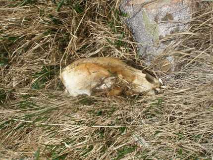
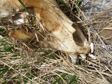
I thought the skull seemed a little long for a cat, but it didn't occur to me that another animal of similar size with such ferocious
teeth would be up in that moraine. When I got back to the city I showed Karlene the pictures and she said, "I bet it's a black bear." A
quick google search
confirmed her hypothesis (she has a knack for these things as she has lived many lives as many different animals as well as one as a
forensic biologist). So I started wondering what a black bear was doing up so high. Maybe they venture there; I don't know. Also, the
skull seemed pretty small for a bear. The length of the entire skull was only about 2⁄3 the length of my foot (which is close to 12"),
so I'd say it was about 8" long. I really wish I put something in one of the pictures for scale, but I didn't. So I'm free to speculate that
the bear was actually a cub that was hunted by a mountain lion. That would explain why its bones were splayed like a finished meal.
Whatever the correct story may be, the bear skull was awesome and haunting. Somehow it died up in that bowl, and while its death was likely
somewhat unpleasant, its resting place is a pretty good spot for a soul to soak back in. So I've taken to calling that glacial carving
Bear Bowl.

Panorama of Three Unnamed Peaks and first lake above Lake Dunraven. The picture links to a larger version.
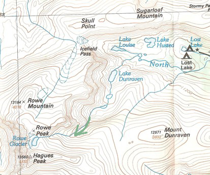
On this map I've marked the spot where I was sitting to take the above panorama. This was on the way out of the drainage after I'd been up in Bear Bowl. By this time it was mid afternoon, and there were a lot of clouds and sporadic rainstorms. I was determined to get some good photos of the view, so I waited through a fair amount of rain. When the sun finally poked out for a few minutes this is what it looked like. To get really great pictures of the scene you'd need to get there early in the morning (like before 7:30 or so). But the green, sloping hillsides were covered in wildflowers, the lake (first above Dunraven) had such a beautiful color, and I had nowhere to be, so I just sat and spent some time with the crags.
Were I to do this hike again I think I would try a different route (shown at right). The idea here is to avoid the narrow, steeper region below Lake Dunraven and take a more direct route. In this route you have to start by climbing up toward Mount Dunraven, but I don't think this is too bad. If it isn't too steep at the beginning it should be passable. Then you would get to Lake Dunraven in no time and would be beyond the first three lakes in the drainage much more quickly. One other difference in this potential route is it goes on the west side of the second lake above Dunraven. On my first pass through I wasn't sure if you could squeeze by on that side, so I stayed to the east and ended up having to do a fair amount of bouldering through a big moraine (that's where I took the spider pictures that are in the picasa gallery). But on the way back I stayed west of the second lake above Dunraven, so I know it's passable (at least in principle, of course it will depend on water and snow conditions). The point is, if you take this route into the base of Bear Bowl you should be there with plenty of time and energy to spare to make it all the way back to the beginning of the drainage at the base of Hague's Peak and Rowe Peak. I'll give it a try next time.
The third lake sits at the base of Bear Bowl. To go beyond the third lake and around Unnamed Peak Three toward Rowe Glacier you have to climb over the saddle which is at the base of the Unnamed Peak Three (labeled with arrow in map at right). When I was there the center of the saddle was covered in snow, but its sides were not. In that case, one could take the snow route or a moraine route off to the side. Right up the middle would probably be easiest even with the snow conditions as they were (especially wearing crampons). I should have done this, and looking back I keep wondering both what it is like back there and also how my day would have been different if I had pushed back toward the final lake and Rowe and Hague's Peaks. I wouldn't have explored Bear Bowl and all its waterfalls and bear skulls, and I probably would have been remarkably tired and hungry, but since I didn't do it on that trip I have a strong desire to go back and check out that last section of the drainage. It is its own world, I'm sure.
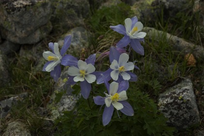
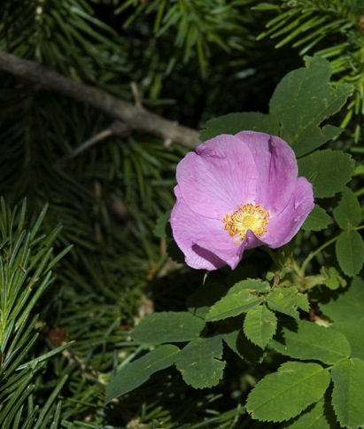
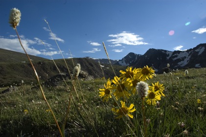
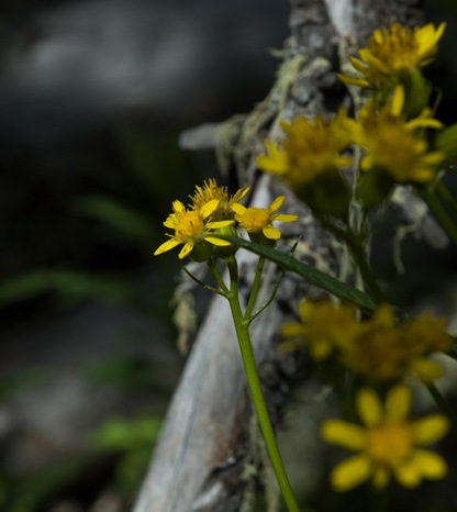
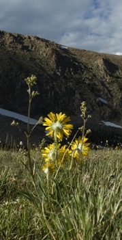
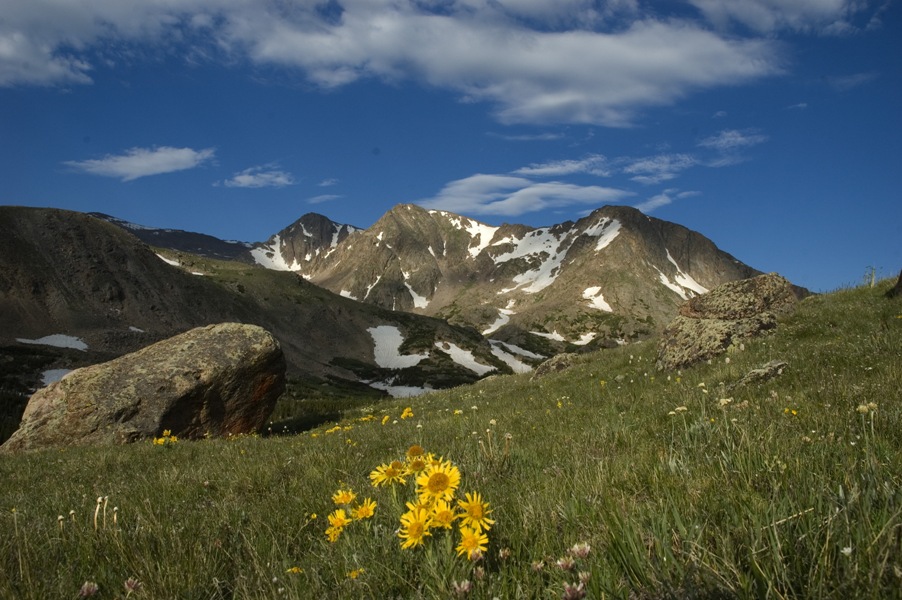
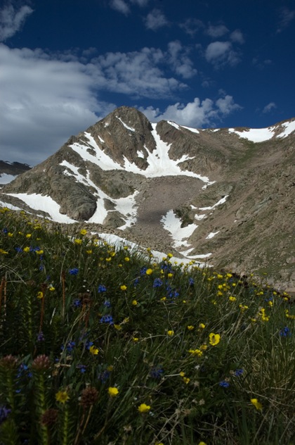
And a trip to the park couldn't be complete without some beautiful wildflowers.